
 You are here: Workshops >> Remote Sensing Methods for Change Detection and Process Modelling >> poster
List of Accepted Posters: 38
| 3D terrestrial laser scanning for field crop modeling D. Hoffmeister, C. Curdt, N. Tilly, J. Bendig Institute of Geography (GIS & RS), University of Cologne, Germany > download abstract | |
| A Split/Merge Approach for Change Detection via Terrestrial LIDAR Jing Wu, Bertrand Merminod Geodetic Engineering Laboratory (TOPO), Ecole Polytechnique Federale de Lausanne (EPFL), Switzerland > download poster |  |
| Analysis of ALOS-PALSAR and TerraSAR-X data for protected area mapping: Case of the Bwindi National Park J. R. Otukeia Department of Surveying, Makerere University, P.O. Box 7062 Kampala, Uganda and Centre for GeoInformatics, University of Salzburg, Hellbrunerstrasse 34, 5020 Salzburg, Austria > download abstract > download poster |  |
| Close-range Laserscanning in the Archaeological Zone Cologne, Germany S. Schreiber, K.-G. Hinzen, C. Fleischer Earthquake Geology / Archaeoseismology Group, Cologne University, Germany > download abstract > download poster |  |
| CROP.SENSe.net - Networking sensor technology R&D for crop breeding and management J. Post, H. Goldbach, K. Schmidt Institute of Crop Science and Resource Conservation (INRES), University of Bonn, Germany > download abstract > download poster | 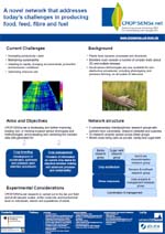 |
| Data reduction and parameter loading in spectral image analysis K. Schmidt INRES IPE, University of Bonn & Nemaplot, INRES Phytomedicine, University of Bonn CROP.SENSe.net > download abstract > download poster | 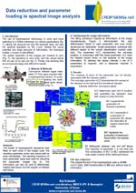 |
| Diagnosis of leaf diseases by modelling analyses of spectral signatures K. Schmidt, A.-K. Mahlein, E.-C. Oerke INRES IPE, University of Bonn & Nemaplot, INRES Phytomedicine, University of Bonn CROP.SENSe.net > download abstract > download poster | 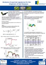 |
| Ecological restoration of the Kalmykian Steppe (Lower Volga Delta, Russia) as a natural result of the discontinued soviet agronomy, detected in remote sensing data from 1962 - 2007 S. Bergsträsser(1), T. Prinz(2) & N. Hözel(3) (1)Institute of Chemistry and Dynamics of the Geosphere, ICG-3, Phytosphere, Forschungszentrum Jülich GmbH, Germany 2)Institute for Geoinformatics/IFGI, University of Münster, Germany 3)Institute for Landscape Ecology/ILÖK, University of Münster, Germany > download abstract | |
| Error estimation of ASTER GDEM for regional applications - comparison with ASTER DEM and ALS elevation models A. Bolten, G. Waldhoff Institute of Geography (GIS & RS), University of Cologne, Germany > download abstract > download poster | 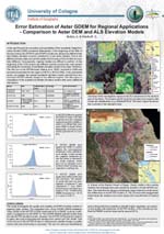 |
| Estimation of Hydraulic Parameters by Simulated Remotely-Sensed Top Soil Moisture Observations with the Particle Filter C. Montzka(1), H. Moradkhani(2), L. Weihermüller(1), H.-J. Hendricks Franssen(1), M. Canty(1) and H. Vereecken(1) (1) Research Centre Jülich, Agrosphere Institute (ICG 4), Jülich, Germany and (2) Portland State University, Department of Civil and Environmental Engineering, Portland, Oregon, USA > download abstract > download poster | 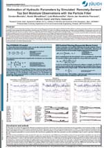 |
| Estimation of vegetation parameters from MODIS FPAR time series, LANDSAT TM and ETM+ products, and ICESAT for the use in erosion modelling B. Schöttker, P. Scarth, S. Phinn, R. Denham, M. Schmidt Centre for Spatial Environmental Research, University of Queensland and Department of Environment and Resource Management, Indooroopilly, Australia > download abstract > download poster | 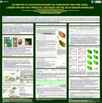 |
| Evaluating airborne laser scanning data for generation of digital elevation models and land cover mapping D.Hoffmeister, J. Bendig, G. Waldhoff Institute of Geography (GIS & RS), University of Cologne, Germany > download abstract | |
| Evaluating the Potential of Different Crop Sensors for Rice Nitrogen Status Diagnosis in Northeast China S. Huang(1,2),Y. Yao(1), M. L. Gnyp(1,2), Y. Miao(1), K. Yu(2), L. Zhao(3), C. Liu(4), R. Jiang(1), X. Chen(1), G. Bareth(1,2) 1. International Center for Agro-Informatics and Sustainable Development (ICASD), College of Resources and Environmental Sciences, China Agricultural University, Beijing, China, 2. Institute of Geography, University of Cologne, Germany, 3. Qixing Research and Development Center, Qixing Farm, Jiansanjiang, China, 4. Jiansanjiang Agricultural Research Institute, Jiansanjiang, China > download abstract | |
| From algorithms to processing chains: A review of land cover and land use change detection methodology F. Thonfeld (1), A. Hecheltjen (1), M. Braun (1,2), G. Menz (1,3) (1) Center for Remote Sensing of Land Surfaces, University of Bonn, Germany (2) Geophysical Institute, University of Alaska, Fairbanks, U.S.A. (3) Geographical Institute, Remote Sensing Research Group, University of Bonn, Germany > download abstract > download poster | 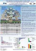 |
| From the Ground to the Space: Multi-scale Detection of Ancient Caravan Routes - Examples from the Western Desert of Egypt O. Bubenzer(1), A. Bolten(2) (1)Department of Geography, Heidelberg University, Germany and (2) Department of Geography, University of Cologne, Germany > download abstract > download poster | 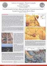 |
| Generation of Discrete Element Models from Laserscans in Archaeoseismology K.-G. Hinzen, S. Schreiber, C. Fleischer, H. Kehmeier Earthquake Geology / Archaeoseismology Group, Cologne University, Germany > download abstract > download poster |  |
| Geospatial monitoring of Land-cover changes: a comparison of three change detection techniques M.Kumar, N. Kumar Department of Soil, Water, Land, Engineering and Management, VSAET, SHIATS, Allahabad, India > download abstract > download poster |  |
| Hydrogeomorphological Investigations in the Vaippar River Basin Tamil Nadu using Remote Sensing and GIS Techniques K. Sankar, K. Pandian, J. Maheswari, M. Ahmad Dar Department of Industries and Earth Sciences, The Tamil University, Thanjavur, Tamil Nadu, India > download abstract | |
| ICASD - International Center for Agro-Informatics and Sustainable Development V.I.S. Lenz-Wiedemann (1,3), Y. Miao (1,2), G. Bareth (1,3) (1) International Center for Agro-Informatics and Sustainable Development (ICASD) (2) College of Resources and Environmental Sciences, China Agricultural University, 100193 Beijing, China (3) Institute of Geography, GIS and Remote Sensing Group, University of Cologne, 50923 Cologne, Germany > download abstract > download poster |  |
| Identification of temporal windows of plant phenology M. Möller, C. Götze, C. Gläßer Institute of Geosciences, Department of Remote Sensing and Cartography, Martin Luther University, Halle-Wittenberg, Germany > download abstract > download poster | 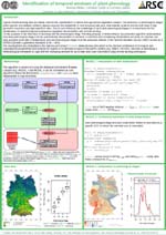 |
| Individual tree detection based on variable and fixed window size local maxima filtering applied to IKONOS imagery for even-aged Eucalyptus plantation forests M. T. Gebreslasie, F. B. Ahmed, J. A.N. van Aardt, F. Blakeway Malaria Research Programme, Medical Research Council and University of KwaZulu Natal, Durban, South Africa, Rochester Institute of Technology, NY, USA and Council for Scientific and Industrial Research, Pretoria, South Africa > download abstract | |
| Interferometric coherence data as an indicator for wind-blown desert dune changes D. G. Blumberg, Y. August, R. Aviram, S. Rotman Ben-Gurion University of the Negev, Beer-Sheva, Israel > download abstract | |
| Kompsat-2 Geometric Quality Assessment for Measuring the Area of European Land Parcels J. K. Nowak Da Costa and A. Walczynska European Commission, DG Joint Research Centre, Institute for the Protection and Security of the Citizen, Monitoring Agricultural Resources Unit, Ispra, Italy > download abstract | |
| Land Use / Land Cover Changes Assessment in The Himalayan Region: A Case Study of Pokhara Sub-metropolitan City, Nepal K. Raj Poudel, R. Prasad Devkota Tribhuvan University Department of Geography, Prithvi Narayan Campus, Pokhara and Environment and Research Management Consultant Pvt. Ltd., Kathmandu, Nepal > download abstract | |
| Mapping spatial variability of soil organic carbon on the field scale via airborne hyperspectral images C. Scholz, A. Mahlein, S. Pätzold, G. Welp Institute of Crop Science and Resource Conservation - Division Soil Science, University of Bonn, Germany > download abstract | |
| Microcopter-Based Color Infrared (CIR) Close Range Remote Sensing as a Subsidiary Tool for Precision Farming C. Knoth(1), T. Prinz(2), P. Loef(3) (1) Institute for Geography, (2) Institute for Geoinformatics, WWU Münster, Germany, (3) CENALO GmbH, Herne, Germany > download abstract > download poster |  |
| Multi-Data Approach for crop rotation mapping G. Waldhoff, C. Curdt, D. Hoffmeister, G. Bareth Institute of Geography (GIS & RS), University of Cologne, Germany > download abstract > download poster |  |
| Multiscale registration and documentation of the Jewish cemetery M. Forbriger(1), C. Siart(1), H. Mara(2), S. Krömker(2), O. Bubenzer(1) (1)Heidelberg University, Geographical Institute, Heidelberg, Germany, (2)Heidelberg University, IWR - Interdisciplinary Center for Scientific Computing vNGG - Visualization and Numerical Geometry, Heidelberg, Germany > download abstract > download poster |  |
| Novel observations for a better understanding of clouds S. Crewell , U. Löhnert , J.H. Schween Institute for Geophysics and Meteorology, University of Cologne, Germany > download abstract | |
| Prospection of carstic caves using GIS and remote-sensing techniques for geoarchaeological research, NE-Morocco Roeloffs, A. (1), Linstädter, J. (2), Wiatr, T. (1), Reicherter, K. (1) & Weniger G.-Chr. (2) DFG CRC 806:"Our Way to Europe: Culture-Environment Interaction and Human Mobility in the Late Quaternary" > download abstract > download poster |  |
| Radargrammetric digital elevation modelling with TerraSAR-X data S.D. Hennig, W. Koppe, N. Kiefl, J. Janoth Infoterra GmbH (EADS Astrium), 88039 Friedrichshafen, Germany > download abstract > download poster | 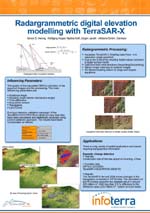 |
| Remote sensing of photosynthetic efficiency in four different crop varieties using hyperspectral and sun-induced chlorophyll fluorescence imaging method F. Pinto, U. Rascher Institute of Chemistry and Dynamics of the Geosphere, ICG-3, Phytosphere, Forschungszentrum Jülich GmbH, Germany > download abstract | |
| Seasonal ground cover monitoring with LANDSAT time series data in the grazing lands of the Great Barrier Reef catchments M. Schmidt, J. Armston, T. Dhar, J. Muir, C. Menges Department of Environment and Resource Management, Indooroopilly, Australia > download abstract | |
| Settlement Process Studies in developing countries using diverse remote sensing data types U. Sturm, A. Christian Braun, S. Hinz and J. Vogt Karlsruhe Institute of Technology - KIT Institute of Photogrammetry and Remote Sensing and Institute of Regional Sciences, Karlsruhe, Germany > download abstract > download poster | 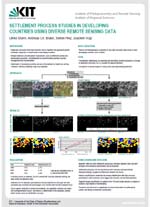 |
| Soil Moisture Estimation under Vegetation from PALSAR FBD Data by means of Polarimetric Decomposition Techniques C. N. Koyama, K. Schneider University of Cologne, Department of Geography, Albertus-Magnus-Platz, 50923 Cologne, Germany > download abstract | |
| Study of electrical parameters of soil, water, diesel and their combinations in Cj band(5.3 GHz) and Ku band(13.4 GHz) S. Hasan (1), N. Ahmadian(1), O. Calla (2) (1) Department of GeoInformatics, University of Pune, Pune, India, (2) International centre for Radio Science, Jodhpur, Rajasthan, 342001, India > download abstract > download poster | 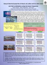 |
| The backscattered signal from terrestrial LiDAR on an active normal fault scarp: The influence of inclination, range, resolution and degradation T. Wiatr, M. Oberrörmann, K. Reicherter Neotectonics and Natural Hazards, RWTH Aachen, Germany > download abstract > download poster |  |
| The DART Project A. Beck, A. Cohn, C. Gaffney, N. Metje, C. Neylon, A. Schmidt, M. Steven, K. Wilkinson School of Computing, University of Leeds, UK DART Project > download abstract > download poster |  |


